
It sounds odd. But when I think of the Eastern Sierras I think of commercials. You know, the ones that feature the mountains and the perfect little family having their picnic under a grove of aspens while they try a new mayonnaise that promises to change their lives. It all looks computer generated because there can’t be a place this beautiful on Earth. No CGI needed, it is in fact that gorgeous and perfect. What one highway in America can you find places like America’s highest peak, 5000 year old trees, the most scenic National park and a prehistoric salt lake featuring calcium carbonate tufas just to name a few. Along this 225 mile stretch you can see the best of what America has to offer.
In this four part series, I’ll take you down this path through an ecological enigma. Deserts, mountains, rare geological formations and all of the absolute beauty that comes with it all. Lets go!!

We have been fortunate enough to spend a combined month in the Eastern Sierra in the last year. We have seen it it in spring, with the lime green tender leaves awakening and full-tilt cascading waterfalls. Summer, in the blistering dry heat of Alabama Hills. Autumn, with the changing leaves of June Lake Loop and Mammoth Lakes. And lastly, old man Winter has shown his bravado with his paralyzing snow storms and bitter cold temperatures. If you have a couple of weeks and a car, get yourself here and enjoy its grandeur. 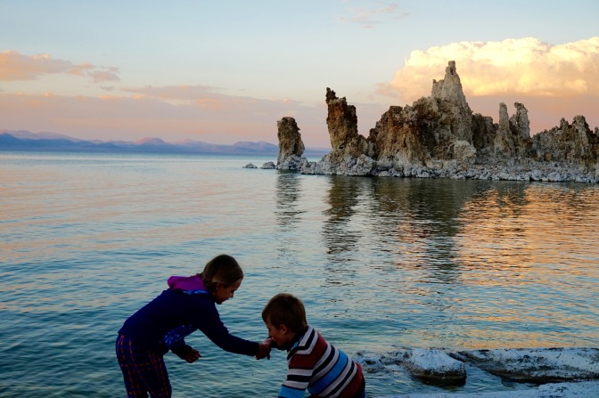
They rise to the East, at first slowly and then abruptly. The Sierra Nevada Mountains keep within her crevices and sheer walls the most awesome display of scenery and diversity in landscapes I have ever seen. Driving north you will start in a desert ecosystem on the southern end of Hwy 395. Blistering heat and dry windswept lands are prominent here with a landscape that eventually ends up in in Death Valley National Park one hundred miles east of Hwy 395. But as you keep driving, not only do you climb in elevation, but the scenery slowly changes from an arid world to a rocky alpine terrain.
Lone Pine, CA
The first noteworthy city as you drive north is Lone Pine. This city would never be on the map without Alabama Hills. Hollywood has gotten to know this city well with over 400 movies having been shot in Alabama Hills since 1920. Her bulbous harsh landscape slowly unveils the main attraction which is Mount Whitney.
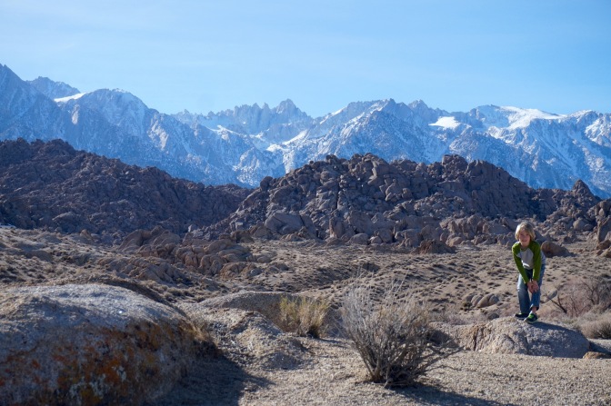
Towering over Alabama hills at 14,505, her jagged snowcapped edges are a sharp contrast to the hills brown-curved forms. The Mount Whitney Portal, which shadows Alabama Hills is the beginning point for the 211 mile trek which is the infamous John Muir Trail. We did some hiking on the John Muir Trail last fall and it is definitely one that keeps you wandering to see what is around the next corner. Many souls have been searched and found on this trail and it is one I intend to conquer before this life is all said and done.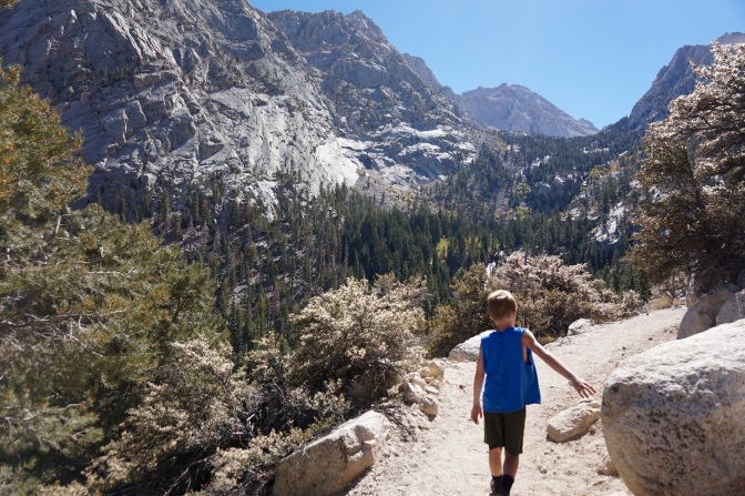
Independence, CA
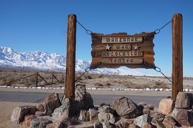
As you keep driving you will pass the city of Independence which is very historical in American History. The Manzanar War Relocation Center is to the left and you would be remiss in not pausing your travels to take this in. Shocking truths about how a segment of America’s population was treated come to reality as you tour through a museum, bunk houses and graveyards. Against the backdrop of the Eastern Sierras, it’s difficult to think that such atrocities occurred in such a beautiful place. Read more in my post about this essential lesson in American history.
The Eastern Sierra Museum is also worth investing time in for the museum and its nineteenth century village and “junkyard” outback. The museum collection furthers the artifact finds of the Manzanar Camp and has an extensive local Naive American collection. But it also has dentures made from coyote teeth and a hand made generator. Outside you’ll find old cars and trains, a school, blacksmith shop and general store along with outhouses. All this to frame the perfect picnic as you eat on the tables provided. As you wander even farther behind the buildings you will find all sorts of twisted metal in the form of stoves, bathtubs and other rusty gold with the prettiest mountain stream meandering through.
So you don’t have to imagine, this will give you the idea.

Big Pine, CA
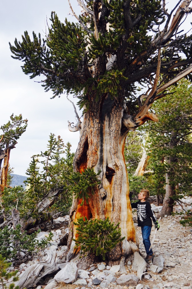
Big Pine is on the map because it also holds your ticket to see the oldest living organisms on Earth, The Bristlecone Pine. Trees have been dated to be older than 5,000 years in the tundra environment of the White Mountains to the east. Be sure that if you want to visit these old man trees you go after the winter snows. You can hike a 4.5 mile hike that will take you by many pines as well as” Methuselah”, a pine that is dated 4,848 years old. For years it was thought to be the oldest living thing on Earth until another pine was discovered and dated to 5,066 years old.
Between Big Pine and Bishop, you can hit Keough Hot Springs and relax in one of several natural pools at a comfortable temperature of 98 degrees.
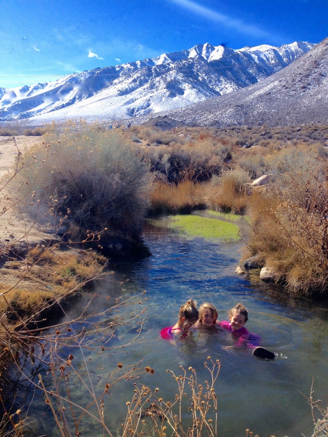
There is also a man-made pool beyond the natural pools where you can soak for a fee. But we stopped here and really enjoyed ourselves and it was free!
Bishop, CA
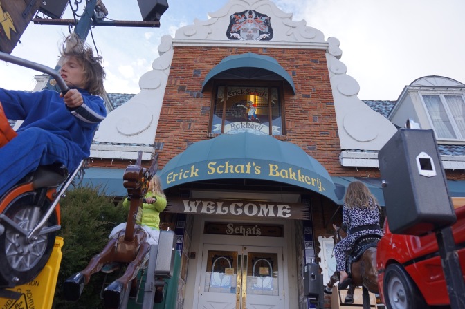
Bishop itself is the largest city you will encounter to this point and there is shopping , restaurants, hotels and rv parks. Many use this city as a base for all the activities that I’ve mentioned. Our favorite stop in Bishop was Erik Schat’s Bakkery. It is really a feast for all senses, especially if you like baked goods. They are famous for sheepherder bread, but they don’t stop there. Just make your way in and you will smell all the goodies they have to offer! I took an interior photo but then got into trouble. They don’t like the possibility of their secrets getting out!
Beyond Bishop, you will climb, climb, climb in elevation and the change is incredible outside your window. Next stop Mammoth Lakes. Stay tuned to learn more about Mammoth Lakes and June Lake. My favorite part of America!

Really enjoyed this latest installment and look forward to the next one.
LikeLike
Really great post of a not so traveled area.
LikeLike
Catching up on your blog. You need to make a Shutterfly book of all of this when it is done. And I want one!! Just fabulous!!
LikeLike